Anyone who has ever driven through the Ennstal has certainly admired the Grimming. The Grimming (2351 m / 7713 ft), which is geologically part of the Dachstein massif, is considered the highest free-standing mountain in Europe thanks to its topographic prominance of 1518 m (4980 ft). Not least for this reason, the awe-inspiring mountain has always exerted a great fascination and was long mistakenly considered the highest mountain in Styria due to the steep ascent from the Ennstal. Today we know that 41 Styrian mountains, most notably the Dachstein (2995 m / 9826 ft), are higher.
The sight of the mountain exerts a great attraction on mountaineers, but also inspires respect in every aspiring summiteer. And rightly so: There are essentially three routes up the Grimming and none of them is easy. From the Ennstal, the ascent of the "Hohe Grimming," as it is often called, can be tackled starting from the Niederstuttern car park either via a partially secured climbing path over the Multereck (2176 m / 7139 ft) or via the even more difficult south-east ridge (UIAA II). As an alternative, there is the north ascent, which also starts from the car park in Kulm and leads to the summit via the Schartenkar cirque, which is also partially secured.
You have to literally "feel your way" up the mountain and so I made the decision to avoid the south-east ridge and instead cross from the north over the Schartenkar and descend over the Multereck into the Ennstal. Early in the morning at 5 a.m. I set off from the car park in Kulm, not far from one of the largest ski jumps. From the beginning, the initially wide but rocky path leads steadily upwards through the forest. After just 15 minutes, the first views of the Grimming rock faces open up and after just over 30 minutes you leave the forest behind you. The path has now become a narrow path. The mountains rise up in front of you. The rest of the path can also be guessed at and the first steep step up into the Schartenkar cirque is already clearly visible.
After about 2.5 km and 1 hour and 15 minutes, the first section of the tour is completed. Now the leisurely hike is over and the path leads up the steep slope, mostly secured with fixed steel cables.
The via ferrata is rated A/B and therefore not really difficult, not very exposed and not too steep. Nevertheless, surefootedness is of course a prerequisite. At this point, it is advisable to wear a helmet, especially since other climbers and chamois could trigger rockfall.
There are always interesting spots, such as the one here where a large boulder seems to be just waiting to rush down the gully, similar to a ball track. Of course, the path leads up through this gully.
After about 30 minutes, the steep slope is overcome and the wide cirque is directly in front of you. The rest of the route is clearly visible from here and crossing the cirque turns out to be surprisingly comfortable and unproblematic - in contrast to the gravel slopes that await me on the way down.
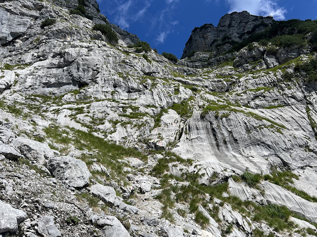
After another 30 minutes, you reach the impressive rock face and you can guess what will happen next. The closer you get, the better you can see the numerous red-white-ref markings along the alpine path. One thing is clear: the climbing begins now and it goes up quite steeply.
As expected, the climb now goes steeply towards the summit. Now you have to use your hands to manage the path leading up the rock face. There are plenty of footholds and handholds and the rock is solid throughout. However, you won't find any rope safety devices here, but that doesn't spoil the fun.
The path is definitely exposed, but still feels surprisingly "safe". In the upper section in particular, you have to pay close attention to the numerous markings. Some paths that appear to be well-trodden can lead you astray and before you know it, you are standing on a narrowing ledge of rock and realize that this cannot be the way. It is also worth taking a look back into the cirque. The scenery is simply impressive.
And it continues upwards. After about an hour of wonderful, easy climbing (UIAA I), you reach a final section secured with a fixed steel cable. Once you have overcome this difficulty, you approach the exit from the rock face.
After an hour and 10 minutes you reach the exit and now it is not far to the summit of the Hoher Grimming.
Now it's time to enjoy the panoramic view. The Schartenspitze (2328 m / 7638 ft) towers above the cirque and to the west the Dachstein glacier shimmers in the morning sun. A quick glance towards the rising sun also reveals the summit cross and makes it clear: it's not far now.
From here it is a 15-minute walk to the highest point of this magnificent mountain. This first takes you past the bivouac box, which can offer mountaineers shelter in the event of sudden changes in the weather.
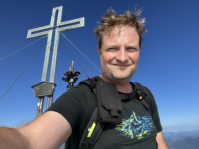
After about 3.5 hours of ascent, the summit of the Hoher Grimming (2351 m / 7713 ft) is reached. It was a strenuous and steep climb, but at no point was it unpleasant.
The panoramic view from the summit is magnificent. In the west, the Dachstein seems close enough to touch, in the northwest the mountains of the Salzkammergut are clearly visible and in the northeast the Totes Gebirge rises into the sky. Only the view down into the Ennstal and across to the Niedere and Hohe Tauern in the south was denied to me due to clouds.
The rising clouds over the Ennstal valley created a very unique atmosphere at the summit, which is why the lack of visibility to the south did not dampen the joy of reaching the summit. On the way down I would still be able to catch enough views of the Ennstal valley.
After half an hour at the summit, the route continues to the next stage destination: the Multereck (2176 m / 7139 ft). The route goes downhill over jagged rocks, large boulders and sometimes lush grass.
Here, too, it is worth taking a look back at the summit every now and then.
Again and again, short climbs have to be mastered in order to overcome ridge towers. Potentially dangerous sections are even secured with fixed wire ropes.The Multereck (2176 m / 7139 ft) has to eke out its existence in the shadow of the Hoher Grimming without a summit cross. It is reached after an hour and invites you to take a short break before starting the steep descent into the Ennstal.
tbd At first, the surroundings are dominated by rocky meadows and the path makes its way down towards "Kasten Kar". The closer you get to it, the more gravelly the path becomes, which first leads along the flank with wonderful views into the cirque and finally leads diagonally down into the cirque.
The descent over the scree field turns out to be quite unpleasant and slippery and requires full concentration. From the Kasten Kar down into the so-called "Schneegrube", you have to overcome a steep section, which is mostly secured with fixed steel cables. This section of the via ferrata is classified as difficulty level B in parts, but does not pose too great a challenge.
From the hut it is only about 45 minutes to Niederstuttern in the Ennstal. A wonderful tour ends at the car park next to the main road. Finding a taxi that will take me back to the car park on the north side of the Grimming was to be the last challenge of the day.
Of course, the tour can also be done in the opposite direction. It should be noted that the starting point at Kulm in the north is more than 300 meters above the alternative starting point in Niederstuttern and the southern ascent is definitely more exposed on hot summer days than the more shady northern ascent. In any case, crossing this special mountain is worth it.Distance: 11.6 km (~ 7.2 mi)
Duration: 08:15 h (without breaks)
Ascent altitude: 1392 m (4567 ft)
Useful links:


Comments
Post a Comment