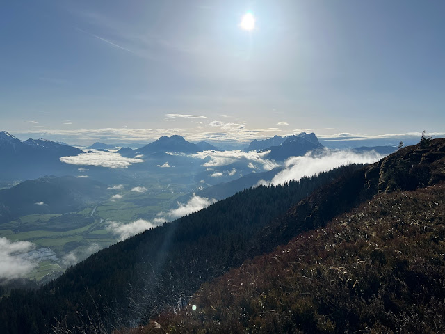
If you look downstream from Liezen, the previously very wide Enns Valley seems to be encountering a major obstacle. At Selzthal, the unspectacular Dürrenschöberl (1737 m / 5698 ft) rises up and separates the Ennstal from its side valley, the Paltental, which branches off to the south-east. This unique location makes the Dürrenschöberl a worthwhile destination, which can be approached from several sides. The ascent is rewarded with a truly breathtaking panoramic view from the rugged peaks of the Gesäuse to the Dachstein Glacier.
The Dürrenschöberl can be tackled from all directions. From Frauenberg in the north, Admont in the northeast, Rottenmann in the south or the small municipality of Selzthal in the west, which this time should be the starting point of the tour.
Not far from the municipal office, a signpost points the way up. Follow a narrow road, which after a few meters turns into a gravel path and leads past a few houses. You quickly arrive at the edge of the forest, where you get back onto a paved road. After a few minutes walk, the marked path (651a) branches off. The forest path is a bit steeper in places, but it is by no means difficult. After some time, a gravel road crosses the path, which now turns and zigzags steadily upwards along the north-western flank of the mountain. After a second hairpin bend and another crossing of the gravel road, the forest becomes lighter and the first wide views of the large train station at the foot of the mountain, the district capital Liezen and the Enns Valley upstream open up.
Again and again the gravel road crosses the path through the partly cleared forest. At an altitude of approx. 1280 m (4199 ft) the path leads past the Perlbach springs and a few minutes' walk later it turns right and winds straight up. Finally, the trail meets the gravel road, which has already been crossed several times, one last time. Once again, the path to the summit follows the road for a few meters before the path branches off to the right once more. At this point, the summit cross can already be seen in the distance. Although a large part of the ascent has already been completed, the goal does not yet seem within reach. The path leads steadily upwards through a beautiful, sparse forest. A last ascent has to be overcome before the summit plateau is finally reached after 2.5 to 3 hours and the summit cross clearly marks the highest point of the Dürrenschöberl.The view to the northeast is dominated by the imposing Haller Mauern with their peaks visible from afar (Bosruck, Großer Pyhrgas, Scheiblingstein, Kreuzmauer and Hexenturm)
To return to the starting point, the descent takes place via the ascent path. The view of the Grimming proves to be a constant companion. As soon as the gravel road is reached, this can be chosen as an alternative route to the hiking trail (651).
After 1.5 to 2.5 hours you have reached Selzthal again and can look back satisfied on a tour with unexpectedly great views.
Tour Facts (Tracked with Bergfex Tours):
Distance: 12,6 km (~ 7.8 mi)
Duration: 03:45 h (without breaks)
Ascent altitude: 1073 m (3520 ft)
Useful links:


Comments
Post a Comment