From the picturesque village of Hohentauern at the top of the Triebener Tauern Pass, a magnificent view of the Bösenstein massif opens up. The 2448 meter (8031 ft) high Großer Bösenstein dominates the breathtaking panorama and not least because of the scenic charms of this area, the Großer Bösenstein and the surrounding peaks and clear mountain lakes are very popular. Nevertheless, only the few know that the Großer Bösenstein was originally called Pölsenstein, derived from the Pölstal valley to the south.
The car park in the immediate vicinity of the Scheibelalm at around 1650 m (5413 ft) above sea level, which can be reached from Hohentauern via a toll road (EUR 8 for a car, as of 2023), is a popular starting point for the routes on and around the Bösenstein. The circumnavigation of the lake or the so-called Hauseck tour, which leads over the nearby summit of the 1982 m (6502 ft) high Hauseck, are definitely suitable for families. In addition, the Edelrautehütte is a good place to quench your thirst and eat well. An alternative to this is the managed hut on the Scheibelalm, which scores with a particularly rustic flair.

The aforementioned parking lot at the end of the toll road also serves as the starting point for the tour described here, which takes in several peaks around the Großer Bösenstein. Especially in summer, a start before sunrise is definitely recommended, especially since the fresh early temperatures make it a little easier. Starting from the car park, a gravel road leads past the Scheibelalm hut to the Edelrautehütte. In front of the hut, hiking trail 944a turns sharply to the right and leads as a forest path, first level and then downhill through a picturesque forest around the Hauseck (1982 m / 6502 ft). Again and again, streams get lost on the path, which is why the path can be slippery and should therefore be enjoyed with a certain degree of caution.
.png)
Finally, the forest thins out more and more and the Ochsenkar is reached. After crossing a small creek, the path curves left over the pasture to the southern flank of the "Große Rübe" (2093 m / 5866 ft). At this point, the path leads continuously upwards, although it is not the incline but the wetness that can cause difficulties. The path finally becomes a little steeper and, at the foot of the Seekarspitze (2115 m / 6938 ft), overcomes a first steep step in the terrain in a large hairpin bend. The view back to the Ochsenkar is fantastic and in the south-east you can admire the previously circumvented Hauseck and the Großer Hengst (2159 m / 7083 ft) towering behind it.


Now continue left over rocky terrain steeply uphill along the ridge in the direction of the Sonntagskarspitze. While a steep meadow slope leads into the valley on the west flank, the east flank shows its rugged side and repeatedly opens up impressive views down over steep rock faces. At this exposed point, the wind can sometimes blow stronger along the ridge and the path along the steep slope on the right side and repeatedly exposed areas on the left side requires sure-footedness.


It goes steadily uphill along the red-white-red markings until the path swings slightly to the south, becomes flatter and the summit cross seems close enough to touch. The comparatively short route from the Sonntagskarspitze (2350 m / 7709 ft) via the Dreisteckengrat takes 1.5 hours to reach the highest peak in the Rottenmanner Tauern. At least now the loneliness of the last few hours is over. Coming from the Edelrautehütte via the Hauseck (1982 m / 6502 ft), the Großer Bösenstein (2448 m / 8031 ft) is a very popular excursion destination that can be reached in around 2 hours. So it can happen that a number of mountain enthusiasts cavort on the summit.

As expected, the view is great! In the north, the peaks of the Haller Mauern and the Gesäuse dominate the view and in the west, the Dachstein massif, the Totes Gebirge and the striking Grimming tower into the sky. The whole of the lower Tauern is literally at your feet and the view of the further course of the tour over the Kleiner Bösenstein (2395 m / 7857 ft) to the summit of the Großer Hengst (2159 m / 7083 ft) is no less impressive.
Depending on how you feel on the day, you can descend directly to the Edelrautehütte via hiking trail 946 or tackle the slightly longer tour via the Kleiner Bösenstein and the Großer Hengst back to the starting point. On hiking trail 944, around 125 meter must first be descended into the saddle. Then follows the ascent to the Kleiner Bösenstein (2395 m / 7857 ft), the summit of which is only marked by a cairn.
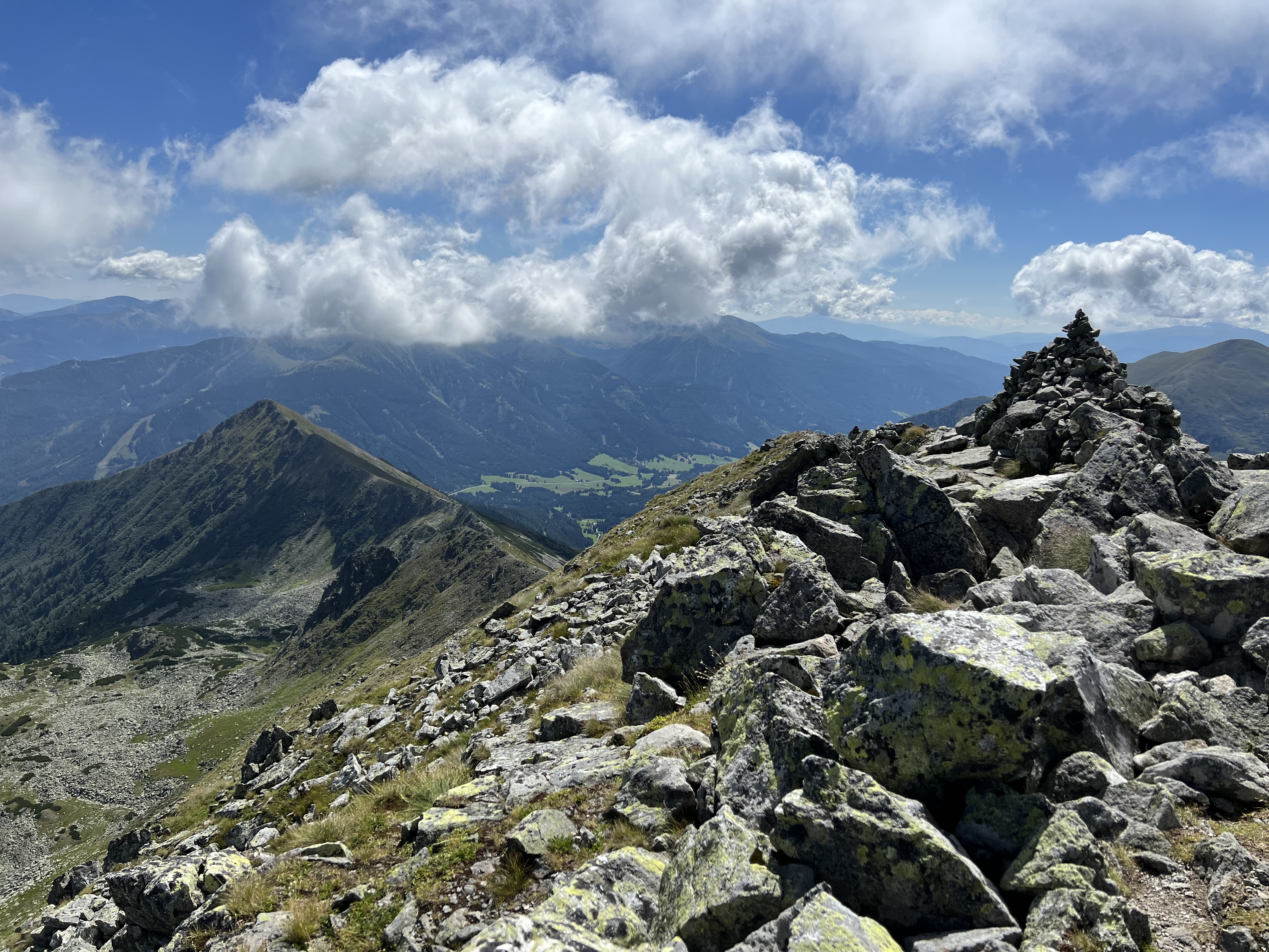
The further course of hiking trail 902 along the ridge can be clearly seen from here. The path does not present any difficulties, but it always impresses with magnificent views of the surrounding mountains.


Once again, the scenery is really impressive. In particular, the view back to the towering Großer Bösenstein, the Kleiner Bösenstein to his left and the peaks of Dreistecken and Hochhaide to his right reveal the dimensions of the current tour. The large Scheibelsee, the mountain lake at the foot of the Großer Bösenstein, fits into the picture particularly picturesquely.

Tour Facts (Tracked with Bergfex Tours):
Distance: 12,9 km (~ 8.0 mi)
Duration: 07:00 h (without breaks)
Ascent altitude: 1131 m (3710 ft)
Useful links:
Comments
Post a Comment