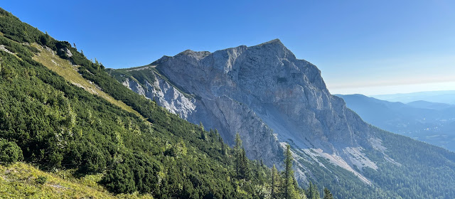
The Haid-Steig, named after a former mayor of Reichenau, leads to the 1783 m (5850 ft) high Preinerwand and is rightly described as one of the boldest via ferratas in the Vienna area. Its history goes back to the beginning of the 20th century. In the years between 1910 and 1913, the Haid-Steig was built by the Viennese locksmith August Cepl according to the plans of the alpinist and painter Gustav Jahn and thanks to financing from Camillo Kronich. The trail, steeped in history, is known far beyond Austria's near border with its eastern neighbors and, like the entire region around the Rax-Schneeberg massif, enjoys great popularity.
It is therefore advisable to avoid weekends or start early in the morning, especially in the summer months when the trail may be very busy. Both the large car park at Preiner Gescheid and the smaller car park in Griesleiten are popular starting points for climbing the Haid-Steig. Due to the shorter approach to the via ferrata, the Griesleiten car park was chosen for the tour described here.
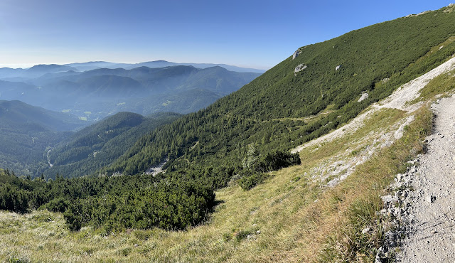
First you follow the forest road. Instead of winding your way up, you can choose the yellow marked path through the forest. This leads a little steeper up and crosses the forest road. At the third meeting with the forest road, a sign points the way to the right onto a path now marked green through the forest towards "Holzknechtsteig" and "Haid-Steig". Again the path crosses a gravel road twice before finally reaching an intersection where there is once again a sign pointing the way in the direction of Haid-Steig. This time we continue to the left, steadily up the mountain, following the red markings. After around 500 m (1640 ft), the Preinerwandsteig branches off to the right. We continue straight on to the Haid-Steig, whereby the path now climbs gently along the southern flank of the Preinerwand. The "Preiner Schütt", a channel filled with gravel and loose rock, is crossed.
Then the forest thins out noticeably and you follow the path through the gravel fields to the entrance to the Haid-Steig (1360 m / 4462 ft). The beginning of the via ferrata was reached after just over an hour. A yellow plaque marks the beginning of the first ascent, which is secured with a fixed steel cable. The board points out the need for sure-footedness and a head for heights, as well as the danger of falling rocks and falling. In fact, the Haid-Steig is considered difficult (C/D according to the Schall via ferrata scale) and is certainly not suitable for beginners.
As can be seen from the topo of the Haid-Steig, the via ferrata can be roughly divided into three sections. After overcoming a first rock step, the path leads over so-called walking terrain and a secured transition to the first steel ladder. While the fixed steel cables and their anchorages were replaced a few years ago, the ladders along the via ferrata are still the originals and are more than 100 years old.The first section is quite demanding. Immediately after the ladder there are very exposed crossings and a steep passage up to the next rock step. In this first section you will move almost exclusively at difficulty level C. Despite the presence of iron rungs, the strength in your arms is definitely helpful in some places.
At the end of the first section, the steel cable also ends and once again rubble and gravel have to be overcome unsecured on the landing of a step in the rock face. At this point it would also be possible to stop the tour and descend to the right via the old Haid-Steig.The Haid-Steig actually has no shortage of wonderful views. Whether it's the surrounding rock formations, the clearly visible plateau of the Rax or the gentle, forested mountains in the south and southeast. The wonderful view during the ascent invites you to take short breaks again and again.
After the second iron ladder, the rock face is crossed again to the top right. Finally, a straddle step is necessary to get over the steep rock face to the large cauldron at the foot of the chimney. Again, a few meters have to be covered without a steel cable. The sight of the steep rock faces all around is impressive and leaves you in awe. Especially in the knowledge that the crux of the Haid-Steig, the climb up the chimney, is getting closer and closer.Climbing the chimney is less difficult than expected. The advice to climb the bottleneck after the ladder as far outwards as possible turned out to be correct. However, tackling this area can be quite challenging, especially when it is wet. There are a few easier passages before the steel cable ends on a small plateau in the immediate vicinity of a column shrine called the “Black Madonna” (1585 m / 5200 ft), which is dedicated to the dead as a memorial and to the living as a warning.
An ideal place to enjoy the wonderful view again and take a short break before tackling the last section of the Haid-Steig. This begins with a short, unsecured climb in the lowest first level of difficulty (-I according to the UIAA scale) over so-called Schrofen terrain along blue markings.
If the weather conditions are good, this area usually does not cause any problems. Finally, the unsecured section ends and a steel cable points the way up. The third section of the Haid-Steig is significantly easier and does not exceed difficulty level B at any point.The view is beautiful. In the southwest, the Karl-Ludwig-Haus, one of many managed huts on the Rax plateau, and the highest point of the Rax, the Heukuppe (2007 m / 6584 ft), are clearly visible. In the south, the region around Semmering is within reach and to the east you can admire the foothills of the Alps. If you look further north-east over the flanks of the Rax, which slope down to the south-east, you can also clearly see the highest point of the nearby Schneeberg, the Klosterwappen (2076 m / 6811 ft).
There are a variety of options for descending. The quickest route is via the Holzknechtsteig back to the entrance to the Haid-Steig and on to the Griesleiten car park. However, the Holzknechtsteig leads over long stretches over gravel, scree and loose rock, which is why alternative routes seem quite interesting. These usually take more time, but are potentially easier to manage. These include the Preinerwandsteig (A/B), which leads down to the east from the Preinerwand summit, or the Göbl-Kühn-Steig, which leads past the Neue Seehütte in the west to the Waxriegelhaus on the Styrian side of the Rax.Finally, the path leads through the forest to the Waxriegelhaus (1361 m / 4465 ft), which is reached after less than 1.5 hours. Here you should treat yourself to a refreshment before heading back along the Bachleitensteig to the Griesleiten car park.
The path back to the parking lot leads once again through the forest and, apart from the dense vegetation in places along the path in the upper part, is manageable without any problems. The stated 1.5 hours back to the parking lot can be beaten relatively easily. After around 4.5 hours (without breaks), a wonderful mountain experience ends back at the parking lot.
Tour Facts (Tracked with Bergfex Tours):
Distance: 10.6 km (~ 6.6 mi)
Duration: 04:30 h (without breaks)
Ascent altitude: 930 m (3051 ft)
Useful links:


Comments
Post a Comment